1,000-foot Tsunami warning! Cascadia megaquake could wipe parts of America off the map | – The Times of India

A newly published study from scientists at Virginia Tech has revealed a sobering scenario that could unfold across the Pacific Northwest. According to their findings, coastal regions in Northern California, Oregon, and Washington face a significant threat of catastrophic flooding and mega-tsunamis—potentially reaching up to 1,000 feet high—due to the combined forces of tectonic activity and climate change. At the center of this alarming research is the Cascadia Subduction Zone (CSZ)—a massive fault line that has remained eerily quiet since the year 1700.As per The Economic Times report, Researchers warn that if a major earthquake were to strike this zone today, the impacts could be far more destructive than previously imagined due to rising sea levels and coastal land subsidence. The study highlights how communities could be overwhelmed in minutes, with thousands of people, homes, and infrastructure in peril.
Cascadia fault: A 600-mile earthquake risk under the US
The Cascadia Subduction Zone (CSZ) is a 600-mile-long fault line that stretches from Northern California to Vancouver Island in Canada. It marks the boundary where the Juan de Fuca Plate is being forced beneath the North American Plate, making it one of the most dangerous subduction zones on Earth.Despite its destructive potential, the CSZ has not produced a major earthquake in over 300 years, with the last one occurring in January 1700—estimated to be a magnitude 9.0 event. Geological records and historical data suggest that another massive quake is not only possible but overdue.
The dual threat: Earthquake + climate change
The Virginia Tech study warns that a major Cascadia earthquake, when combined with climate change-induced sea-level rise, could have a compound effect on the region’s vulnerability. Researchers simulated tens of thousands of earthquake scenarios, analyzing how seismic shaking, land subsidence, and rising seas would interact to create one of the most dangerous natural disasters imaginable.Key findings include:
- Coastal land could sink by up to 6.5 feet during a strong earthquake.
- This would increase the flood-prone area from 35 square miles to 116 square miles.
- Over 14,350 additional people, 22,500 buildings, and 777 miles of roads would be exposed to life-threatening flooding.
The study models both present-day impacts and those projected for the year 2100, when sea levels are expected to be significantly higher.
Mega-Tsunami warning: America’s coastline could vanish in minutes
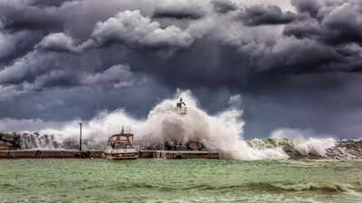
Among the most chilling projections in the report is the potential for a mega-tsunami, with waves that could reach up to 1,000 feet tall—hundreds of times higher than typical tsunami waves.Such a tsunami would:
- Hit within minutes of the earthquake, leaving little time for evacuation.
- Flatten entire coastal cities such as Portland, Oregon, and Seattle, Washington.
- Carry an unprecedented amount of energy, wiping out structures, bridges, and communication lines.
- Cause secondary impacts in places like Alaska and Hawaii, due to the seismic and volcanic activity in those regions.
According to lead researcher Dr. Tina Dura, the “functionally neutral but emotionally explosive” impact of such a disaster would significantly delay recovery for impacted communities and devastate ecosystems.
Why current Tsunami maps are inadequate
The study underscores a critical gap in disaster preparedness: current tsunami maps do not account for the interaction between sinking land and rising seas. These outdated models give a false sense of security and could lead to underpreparedness in emergency planning.By integrating geophysical simulations, climate models, and community data, Virginia Tech’s study aims to provide more realistic hazard assessments, enabling local governments to better prepare evacuation routes, building codes, and public awareness campaigns.
Communities at highest risk
Regions most likely to face catastrophic consequences include:
- Southern Washington
- Northern Oregon
- Northern California
These areas sit directly above or adjacent to the most volatile sections of the CSZ and house dense populations, commercial hubs, and key infrastructure.The study estimates that there’s a 15% chance of a magnitude 8.0 or larger earthquake occurring in the CSZ within the next 50 years, making it one of the most pressing geological threats to North America.
Recommendations for preparedness
The researchers emphasize the urgency for action:
- Revising tsunami evacuation maps to include updated sea-level and land-subsidence data.
- Strengthening infrastructure to withstand shaking and flooding.
- Educating the public about the risk and appropriate response protocols.
- Investing in early warning systems that can give even a few extra seconds of preparation time.
According to The Economic Times report, Dr. Dura notes that community awareness and preparedness can dramatically reduce the scale of disaster. “Knowing what to expect is the first step toward saving lives and protecting the environment,” she says.


